Spend more time and less money on your vacation ~ Spend it here!
Spend your vacation in the Gorham NH area, and you will find great value for your dollar and a friendly helpful atmosphere. Still uncrowded and unspoiled by development, the area offers the best of both worlds. Here, the peaceful mountains surround you and you can still find all the conveniences and amenities you need at a reasonable price.
Step into another world north of the “notch” where you’ll enjoy nearby family attractions, outdoor facilities, museums, plays and concerts. Here you can relax, unwind ... and forget the fast paced world you left behind.
Stay longer, drive less!
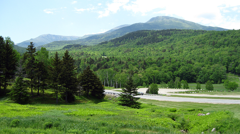
Mt. Washington is the highest in the Northeastern United States at an elevations of 6,288 feet. Photo by Deborah Ryan
Surrounded by the spectacular White Mountains, Gorham is located on the north end of the Presidential Range. The center of this range is dominated by the highest mountain in the northeastern US, Mount Washington, and is only a scenic 10 minute drive south from town. Wherever you go, there are beautiful vistas at every turn.
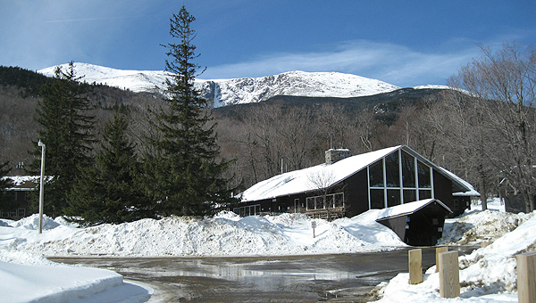
You can connect with snowmobile corridors or ATV Trails from right outside your door, or arrange a shuttle to your favorite hiking trail. A 5 minute drive gets you to the USFS Visitor Center, and 5 minutes more takes you to the Appalachain Mountain Club Visitor Center, Wildcat Mountain or Great Glen Trails!
Photos by Deborah Ryan
Appalachian Mountain Club Visitor Center
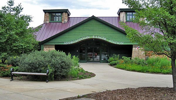
Androscoggin Valley Ranger Station
Great Glen Trails
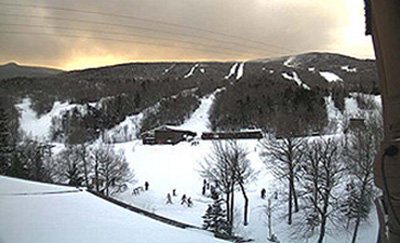
Wildcat Mountain
The Presidential Range
With Mt. Washington at it's center, the Presidential Mountain Range is one of the most dramatic in the east. Reaching well above the treeline, the Appalachian Trail winds among these peaks, all named for former Presidents: Monroe, Franklin, Eisenhower, Washington, Clay, Jefferson, Adams, and Madison.
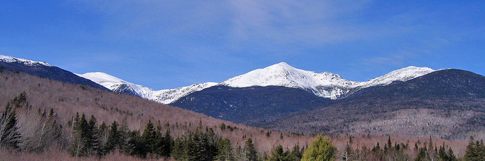
Northern Presidential Range by Deborah Ryan
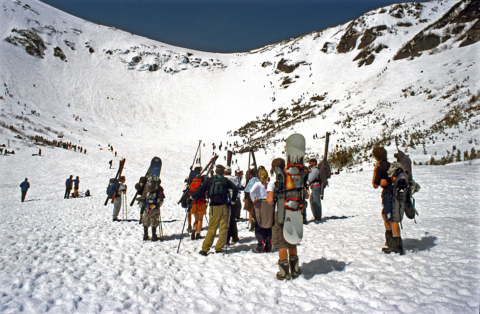
Tuckerman Ravine "Rights of Spring" by Robert Kozlow
Overlooking the Southern Presidentials and Lake of the Clouds from Mt. Washington by Robert Kozlow
Tuckerman Ravine
on the east side of Mt. Washington rises steeply from the timberline and gathers snow all winter. It is a favorite of skiers and snow boarders, who hike to the ravine into late spring when the snow is gone everywhere else. Every April the Friends of Tuckerman host a 5 stage race, the Tuckerman Inferno.
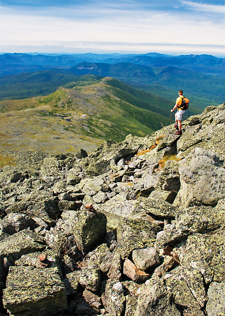
High Huts of the White Mountains
This hiker is on the Appalachian Trail on Mt. Washington looking south across the southern Presidentials with Lake of the Clouds Hut in the distance. Owned and maintained by the Appalachian Mountain Club, the hut system is modeled after similar hostels in Europe, they are positioned about six to eight miles apart allowing thru-hikers to benefit from their services.
Rock Formations
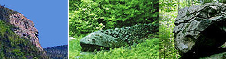
The Imp Face
A natural rock outcropping that resembles an impish face. Visible on the side of the Carter Moriah Range from Dolly Copp Campground and accessible from the Imp Trail on Route 16.
The Stone Fish
The last standing of three stone creations once built by a mason in the town of Shelburne, NH.
The Old Man of the Valley
Yet another of New Hampshire's natural outcroppings that resembles the face of an Indian. It is a large boulder that rests on the side of a trail that begins on the south side of Route 2, near the Maine line in Shelburne, NH.
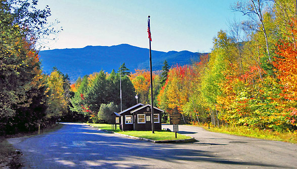
White Mountain National Forest
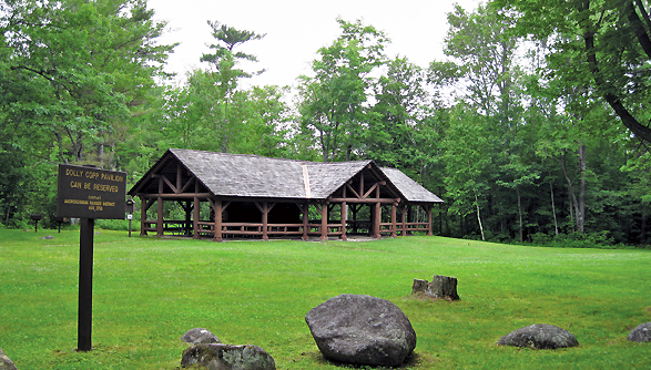
Dolly Copp Picnic Area on Route 16
Dolly Copp National Forest Campground
Peabody River Ledges on Route 16
All Photos by Deborah Ryan
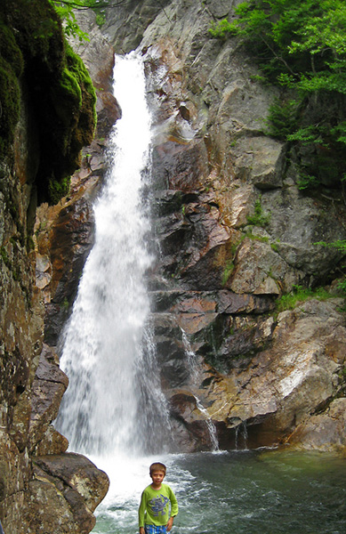
Glen Ellis Falls
Dolly Copp Campground & Picnic Area
About 6 miles south of the town of Gorham on Route 16 by the Peabody River, this campground has quite a history and is an old homestead. Primitive facitlites are available for tents and RV's, and the picnic pavillion is available to reserve for private affairs.
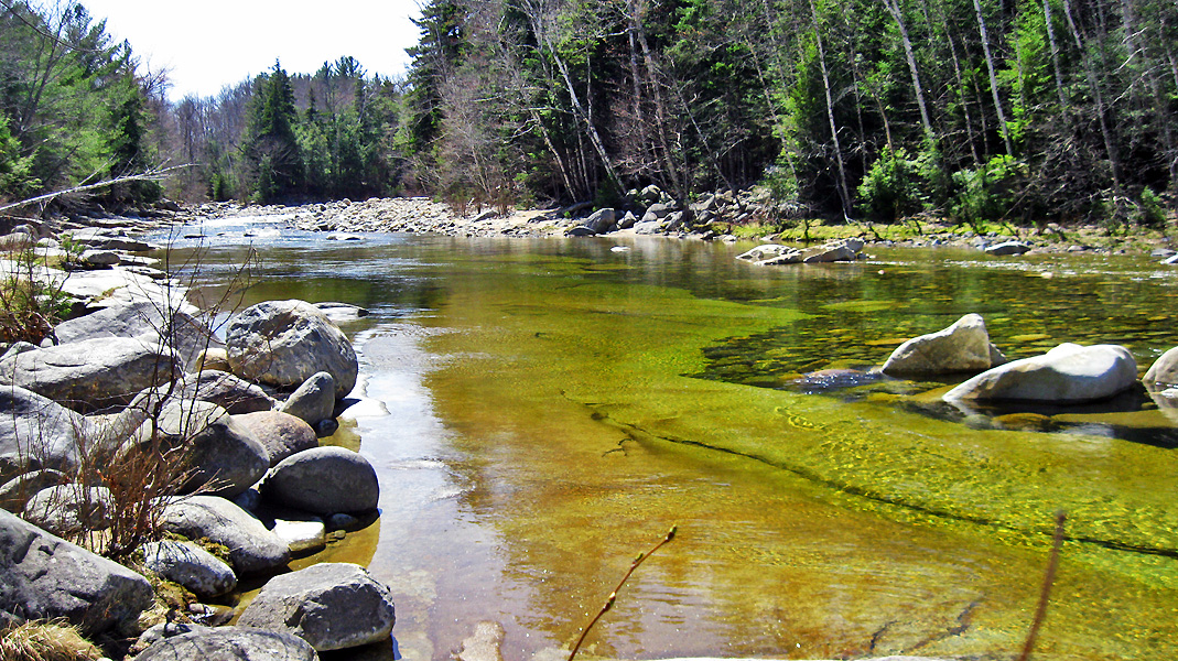
The Peabody River
The Peabody River originates on Mt. Washington and flows north along Route 16 to the Androscoggin River. Its pristine waters are a favorite for swimming and fishing.
Glen Ellis Falls
This waterfall is part of the Ellis River and can be accessed from a designated parking area on Route 16 just south of the Appalachian Mountain Club. Here a trail leads through a tunnel under the road and along the river to a steep drop with stairs. The falls can be viewed any time of year from an overlook halfway down and from the base. This falls is one of many in the area.
Other Points of Interest
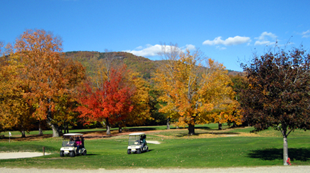
Androscoggin Valley Golf Course
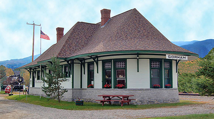
Gorham Railroad Station and Museum
Jericho Mountain ATV Park
Moose Brook State Park
Medallion Opera House
All Photos by Deborah Ryan
Androscoggin Valley Golf & Country Club
18 Hole Scenic Course on Route 2 east end of the town of Gorham.
Gorham Historical Society & Railroad Museum
Railroad Street across from the Gorham Town Common. Tour the train and the museum, call for hours.
Jericho Mountain ATV Park
ATV trail network connecting with Ride the Wilds and the towns of Berln and Gorham where ATV's are allowed on Route 16 the Friday just prior to Memorial Day in May until the first Monday in November (folks can access the trails right on the highway). Features a warming hut and campground available near Jericho Lake. Annual Festival.
Moose Brook State Park
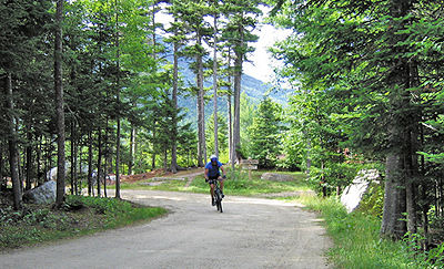
State Park & Campground on the west end of Gorham. Mountain biking trails and access to Rails to Trails nearby.
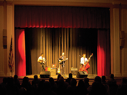
Medallion Opera House
Rennovated as part of the Gorham Town Hall restoration, and host to various performing arts, both local and professional. Many high-caliber musicians have enjoyed playing this quality small town venue.
The Presidential Rail Trail
The local section of the national historic Rails to Trails, is called the Presidential Rail Trail It can be accessed from a parking area on Route 2, at the west end of Gorham, less than a mile west of the intersection of Routes 2 & 16. Additional parking is available on Jimtown Road. The lot is on the left side within a tenth of a mile off Rt 2. The 18 miles of trail from Gorham to Cherry Pond in Whitefield offers great views of the mountains. This part of the trail is not open to ATV’s.